Hike Donner Summit Canyon with Truckee Donner Land Trust - CANCELLED


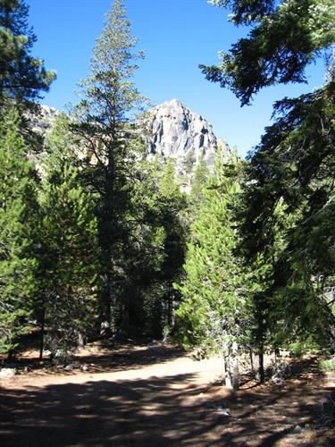
The Truckee Donner Land Trust invites you to hike with us on the trail that loosely follows the original Lincoln Highway route. The route traverses Donner Summit Creek, Donner Peak, and Schallenberger Ridge as it climbs to Donner Summit. Some of the historic features visible from the upper part of the trail include Native American petroglyphs, the China Wall, and the world?s first automobile underpass (1913). Look for the abandoned Turkey Truck that careened off the road in 1955, scattering 30,000 pounds of frozen turkeys down the 175? drop and delaying Thanksgiving dinner for hungry Nevadans!
Hiking details: Enjoy a docent-led, 6+ mile round-trip hike with a 1,000? elevation gain; moderately strenuous due to uneven terrain and moderate to steep ascents.
Date and Time
Saturday Aug 22, 2020
9:00 AM - 2:00 PM PDT
Location
The hike starts at the
Pacific Crest Trail and Donner Peak Trailhead
96161 Old Donner Summit Rd,
Truckee, CA 96161
Directions from downtown Truckee:
Proceed West on Donner Pass Road along the North Shore of Donner Lake. As you approach the West end of Donner Lake, go past South Shore Drive and continue up along Old Highway 40 towards Donner Summit. The trail head and parking area is on the left, roughly 1/3 of a mile from South Shore Drive (If you reach the winter closure gate, you have gone too far).
Fees/Admission
TDLT hikes are FREE!
Please register for this hike at
https://www.eventbrite.com/e/donner-summit-canyon-tickets-92379492549
Website
Contact Information
Truckee Donner Land Trust - 530-582-4711
Send Email


Truckee, CA 96161